---
marp: true
theme: default
paginate: true
size: 16:9
style: |
/* 1. スライド全体の上部余白(padding-top)を詰める */
section {
padding-top: 20px; /* デフォルトの約60-70pxから縮小。0にすれば完全密着 */
justify-content: flex-start; /* 上詰め配置を強制(中央揃えテーマ対策) */
}
/* 2. スライドの最初の要素(h1, h2, p 等)の上部マージンを消去 */
section > *:first-child {
margin-top: 0;
}
---
# The Three-Tier Problem of CNG
### 2 Lessons + 1 Idea from 20 PoCs
[](https://gyazo.com/529ee0a7959ae7b6833fb2a5d83854e8)
Yui Matsumura / yuiseki
Geolonia, Inc.
CNG Japan 2026
---
# The main message
## CNG is not only a storage problem.
## It is also a compute problem.
Cloud-native geospatial storage has enabled something important:
## request-time geospatial computation
---
# What I mean by “Three-Tier Problem”
There are three execution environments:
## Cloud / Edge / Browser or App
And we must decide where to place:
## Storage / Compute / Representation
This placement problem is the Three-Tier Problem of CNG.
---
# The design space
| | Cloud | Edge | Browser / App |
| -------------- | ----- | ---- | ------------- |
| Storage | | | |
| Compute | | | |
| Representation | | | |
## There is no single correct placement.
The right design depends on storage size, transfer time, runtime constraints, update frequency and progress of technology.
---
# How I got here
I built about 20 small PoCs around CNG data.
Not to benchmark everything.
Not to propose a complete architecture.
But to understand one question:
## What becomes possible when
## CNG data is treated as computable input?
---
# Two lessons + one idea
## Lesson 1: Computability
A tile can be a request-time computation result.
## Lesson 2: Antigravity
Cloud-native geospatial data has both gravity and antigravity.
## One idea: Symmetry
Cloud and Edge may share portable geospatial data products.
---
#
---
# Lesson 1: Computability
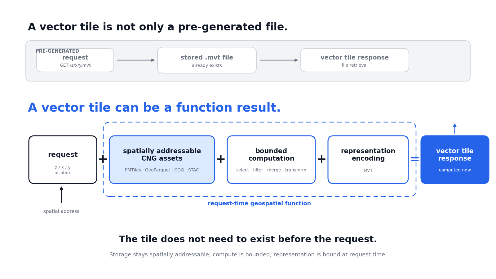
A vector tile is not only a pre-generated file.
## A vector tile can be a function result.
---
 ---
# Why vector tiles mattered
Starting from vector tile responses forced three constraints:
1. computation must be bounded by tile coordinates
2. output must be compact and renderable
3. the function must be fast enough to serve interactively
So the tile becomes a useful unit of geospatial computation.
---
# Introduction to the Demo
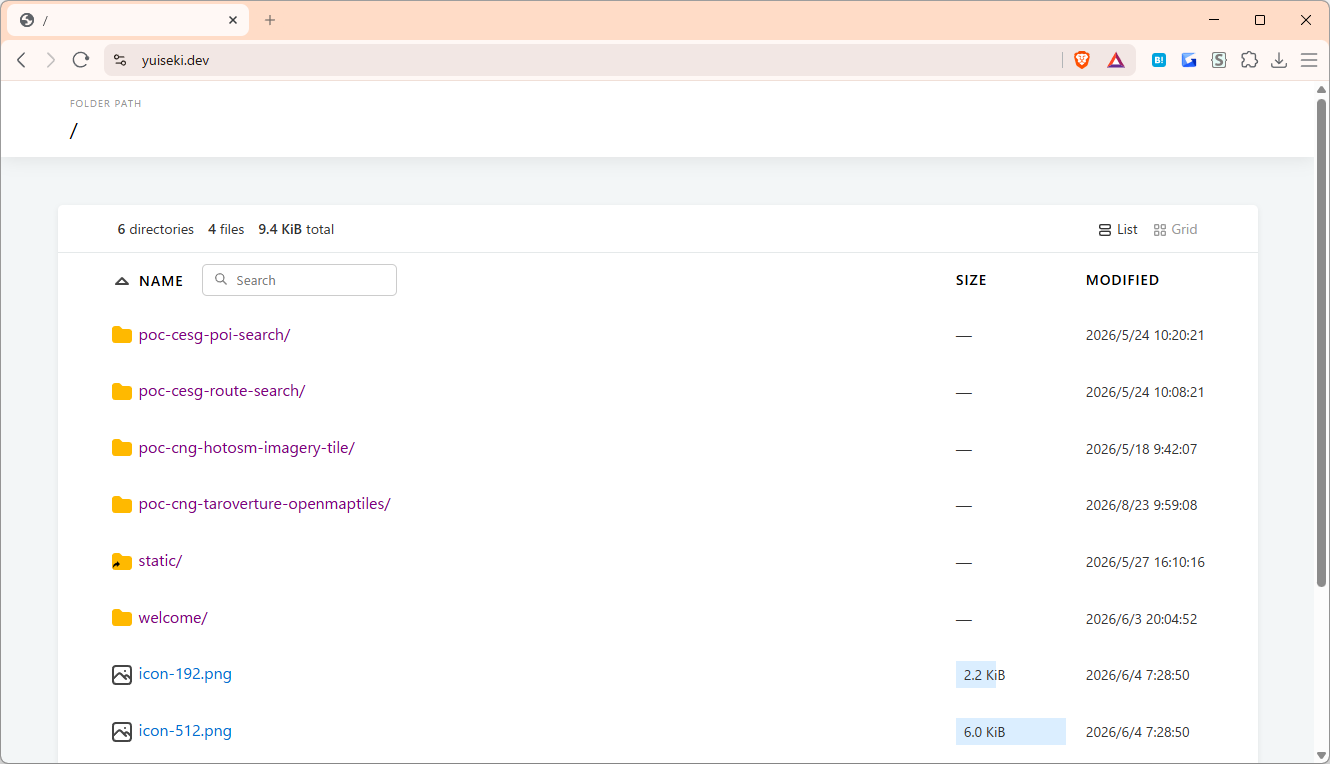
# `https://yuiseki.dev`
---
# Why vector tiles mattered
Starting from vector tile responses forced three constraints:
1. computation must be bounded by tile coordinates
2. output must be compact and renderable
3. the function must be fast enough to serve interactively
So the tile becomes a useful unit of geospatial computation.
---
# Introduction to the Demo
# `https://yuiseki.dev`
 ---
# Demo 1: Dynamic vector tile on `yuiseki.dev`
# https://yuiseki.dev/poc-cng-taroverture-openmaptiles/
---
---
#
---
# Lesson 2: Antigravity
`Data gravity` says:
## large data tends to stay in the cloud.
But CNG data can also have `antigravity`.
When data is:
- chunked
- indexed
- range-readable
- self-describing
useful subsets can escape into portable products.
---
---
# Demo 1: Dynamic vector tile on `yuiseki.dev`
# https://yuiseki.dev/poc-cng-taroverture-openmaptiles/
---
---
#
---
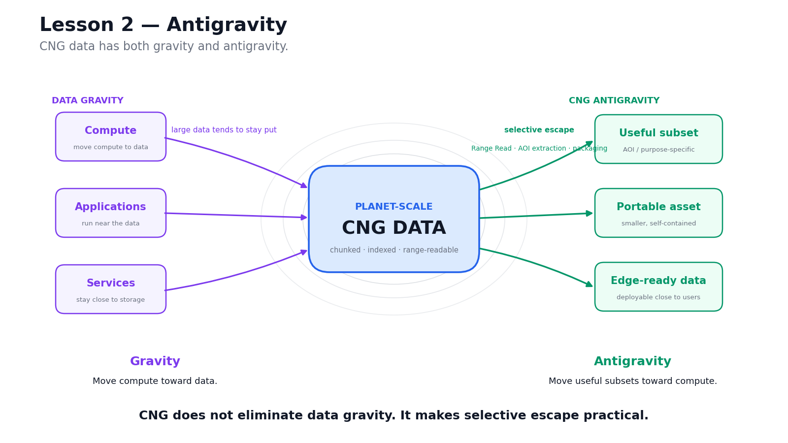
# Lesson 2: Antigravity
`Data gravity` says:
## large data tends to stay in the cloud.
But CNG data can also have `antigravity`.
When data is:
- chunked
- indexed
- range-readable
- self-describing
useful subsets can escape into portable products.
---
 ---
# Examples of Data Antigravity
You can extract from...
- PMTile
- STAC and COG
- GeoPackage
- GeoParquet
---
# CLI tool for data antigravity
- https://github.com/yuiseki/cng-data-antigravity
data moving across tiers:
## cloud-scale source → portable asset → edge-deployable service
## The data can move outward from cloud-scale storage.
---
# Antigravity is not magic
Ideally, the subset preserves native format and provenance.
But the core idea is simpler:
## CNG data can be large enough to stay in the cloud,
### yet addressable enough to escape the cloud.
Practical concerns remain:
- provenance
- licensing
- update strategy
- runtime-specific indexes
---
#
---
# From Antigravity to Symmetry
If data can move from Cloud to Edge,
then we can ask a harder question:
## Can Cloud and Edge share the same portable geospatial data product?
This is the idea I call:
# Cloud-Edge Symmetric Geospatial
---
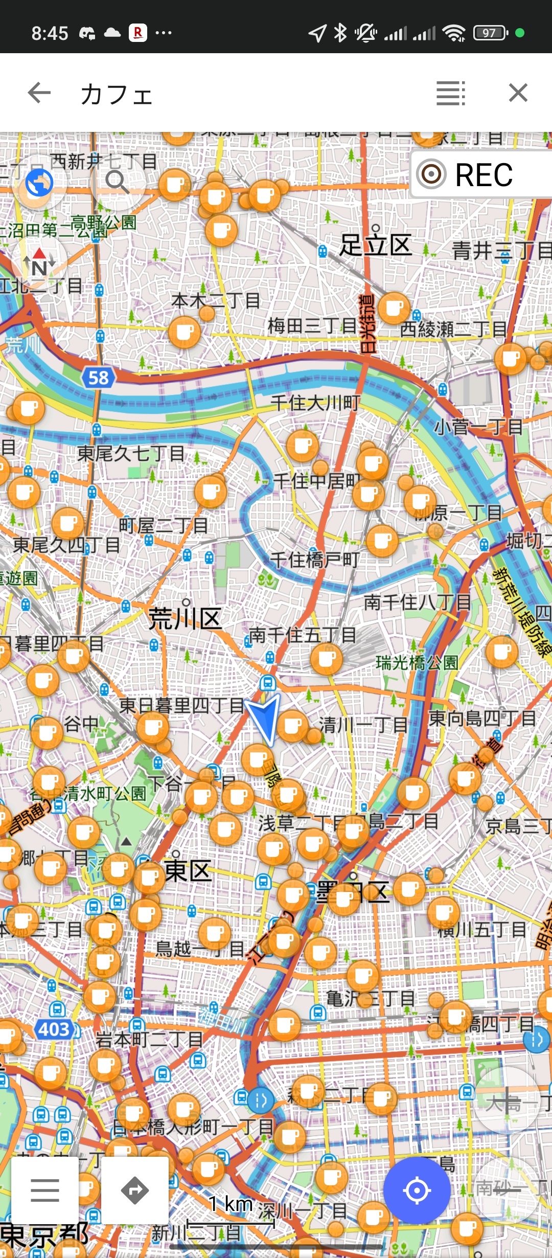
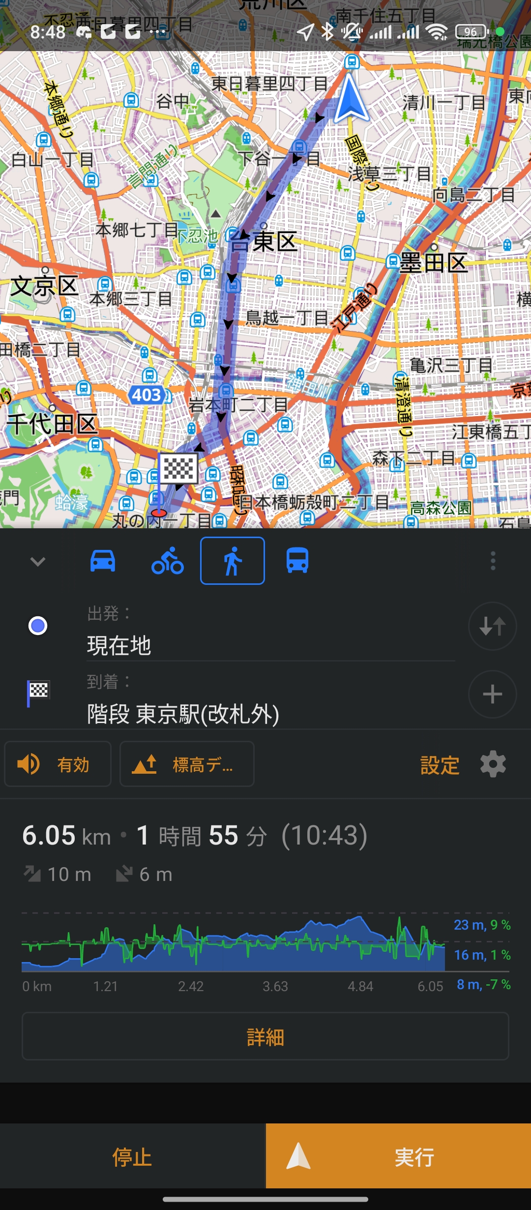
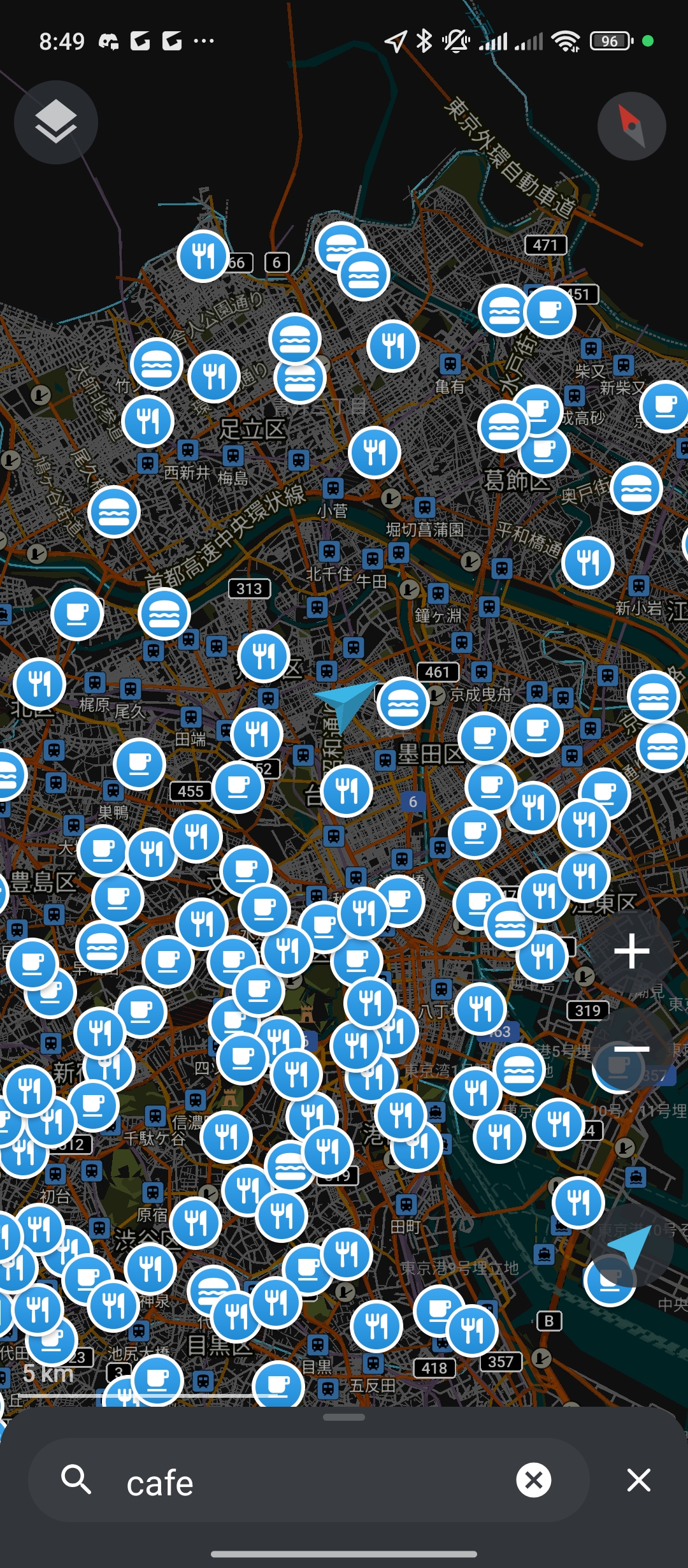
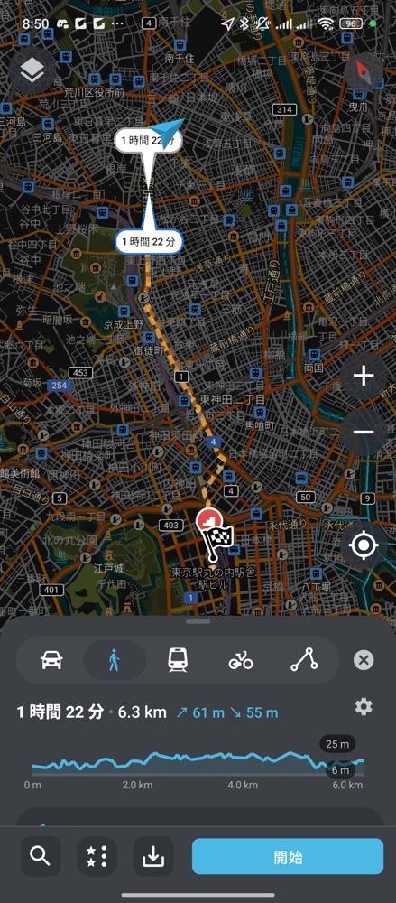
# Edge Native Geospatial
In the real world,
## There are already geospatial data formats that can be handled entirely on smartphones.
---
# Example 1: OsmAnd
---
# Examples of Data Antigravity
You can extract from...
- PMTile
- STAC and COG
- GeoPackage
- GeoParquet
---
# CLI tool for data antigravity
- https://github.com/yuiseki/cng-data-antigravity
data moving across tiers:
## cloud-scale source → portable asset → edge-deployable service
## The data can move outward from cloud-scale storage.
---
# Antigravity is not magic
Ideally, the subset preserves native format and provenance.
But the core idea is simpler:
## CNG data can be large enough to stay in the cloud,
### yet addressable enough to escape the cloud.
Practical concerns remain:
- provenance
- licensing
- update strategy
- runtime-specific indexes
---
#
---
# From Antigravity to Symmetry
If data can move from Cloud to Edge,
then we can ask a harder question:
## Can Cloud and Edge share the same portable geospatial data product?
This is the idea I call:
# Cloud-Edge Symmetric Geospatial
---
# Edge Native Geospatial
In the real world,
## There are already geospatial data formats that can be handled entirely on smartphones.
---
# Example 1: OsmAnd
 ---
# Example 2: Organic Maps
---
# Example 2: Organic Maps
 ---
#
---
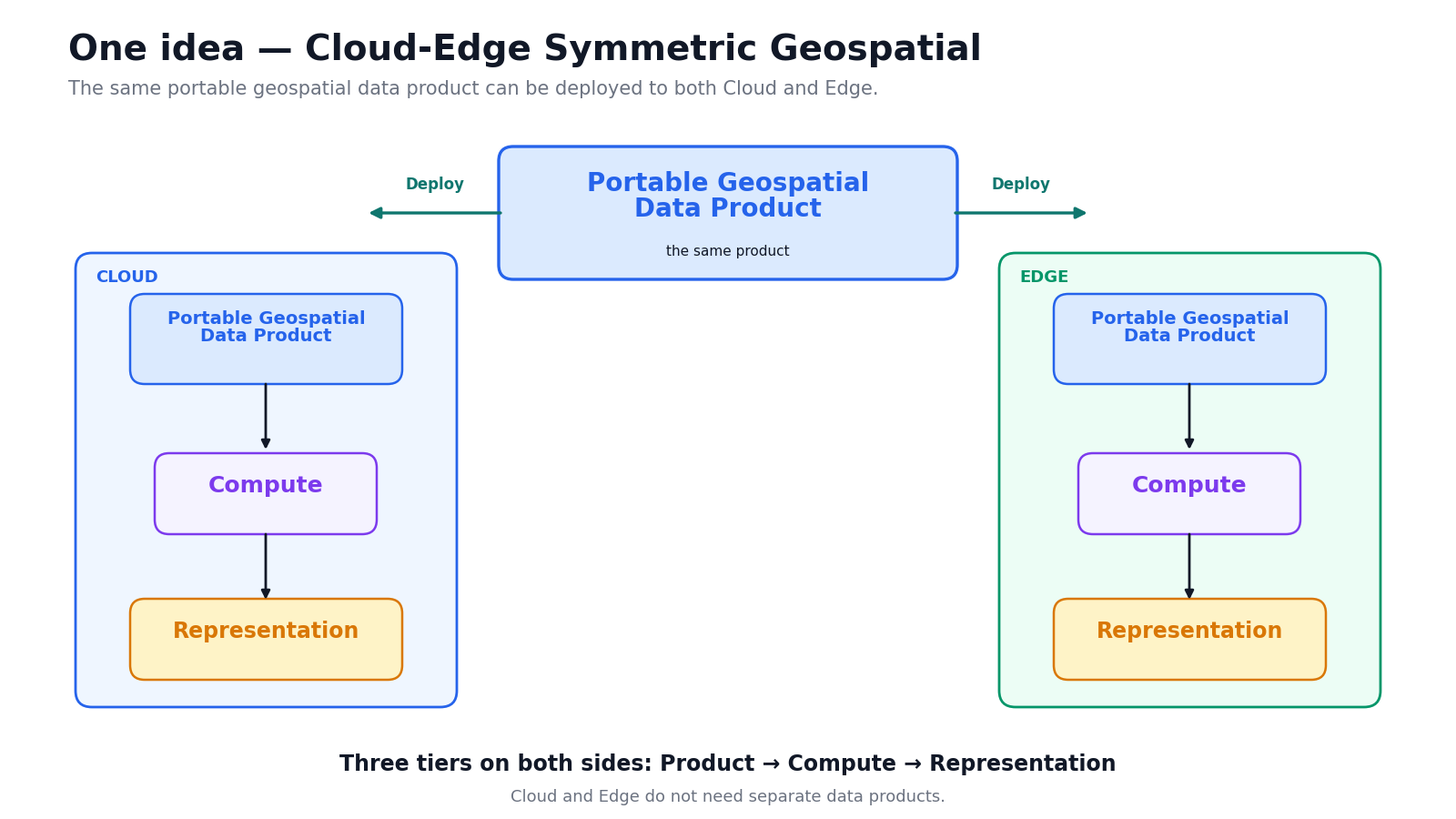
# One idea: Cloud-Edge Symmetric Geospatial
This does not mean:
## “everything runs everywhere.”
It means:
## reduce rebuilds and reformatting between Cloud and Edge
by sharing a portable geospatial data product.
---
---
#
---
# One idea: Cloud-Edge Symmetric Geospatial
This does not mean:
## “everything runs everywhere.”
It means:
## reduce rebuilds and reformatting between Cloud and Edge
by sharing a portable geospatial data product.
---
 ---
# Symmetry across tiers
| Capability | Cloud | Edge | Browser |
| ---------- | ------------------ | --------------------- | -------------------------- |
| search | scalable service | portable local API | local / cached query |
| routing | managed backend | local routing graph | lightweight interaction |
| tiling | FaaS / tile API | local tile API | protocol / rendering |
| analysis | batch / serverless | bounded local compute | constrained client compute |
---
# Demo 2.1: POI search on `yuiseki.dev`
# https://yuiseki.dev/poc-cesg-poi-search/
---
---
# Final takeaway
## The Three-Tier Problem of CNG
is the placement problem of:
```text
Storage / Compute / Representation
```
across:
```text
Cloud / Edge / Browser or App
```
---
# 2 Lessons + 1 Idea
## 2 Lessons
1. Computability
tile = request-time computation result
2. Antigravity
CNG data can escape from cloud-scale storage
## 1 Idea
3. Symmetry
geospatial capabilities can move across Cloud / Edge / Browser or Apps
---
## I look forward to working with all of you
## To build the future of CNG.
---
# Symmetry across tiers
| Capability | Cloud | Edge | Browser |
| ---------- | ------------------ | --------------------- | -------------------------- |
| search | scalable service | portable local API | local / cached query |
| routing | managed backend | local routing graph | lightweight interaction |
| tiling | FaaS / tile API | local tile API | protocol / rendering |
| analysis | batch / serverless | bounded local compute | constrained client compute |
---
# Demo 2.1: POI search on `yuiseki.dev`
# https://yuiseki.dev/poc-cesg-poi-search/
---
---
# Final takeaway
## The Three-Tier Problem of CNG
is the placement problem of:
```text
Storage / Compute / Representation
```
across:
```text
Cloud / Edge / Browser or App
```
---
# 2 Lessons + 1 Idea
## 2 Lessons
1. Computability
tile = request-time computation result
2. Antigravity
CNG data can escape from cloud-scale storage
## 1 Idea
3. Symmetry
geospatial capabilities can move across Cloud / Edge / Browser or Apps
---
## I look forward to working with all of you
## To build the future of CNG.